APN Project
Project title
Integrated Flood and Sediment Management in River Basins for Sustainable Development
Proponent’s information
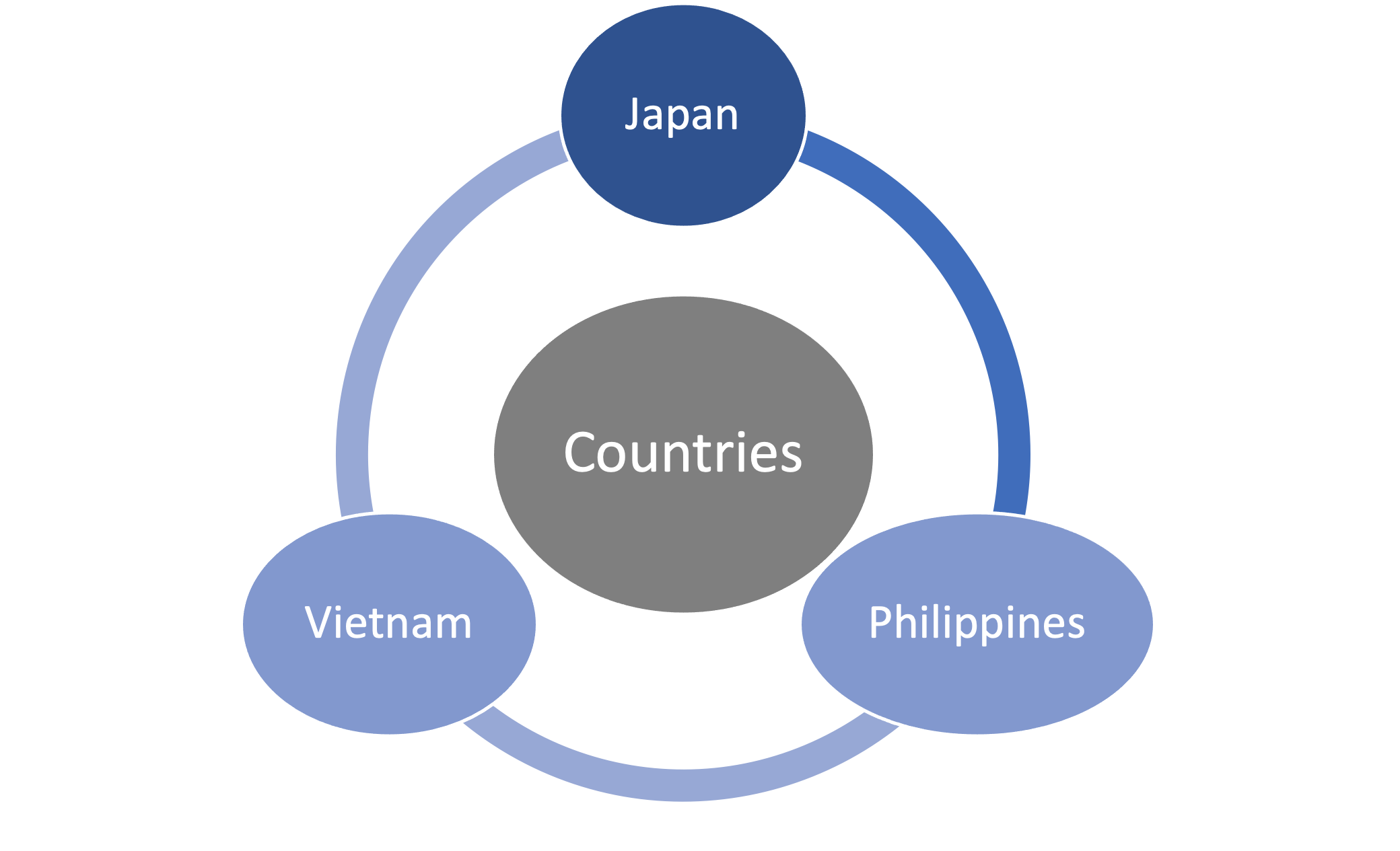
Assoc. Prof. Sameh Ahmed Kantoush Countries involved
Kyoto University, Japan Japan, Philippines, Viet Nam
Project abstract
Climate change poses great threats from disastrous floods and drought to the world, of which Japan, Vietnam and Philippines are among the most affected countries. Human interventions such as deforestation, dam constructions, and expansion of irrigation system have magnified the impacts of climate change. The proposed project aims at assessing the impacts of climate change and human interventions on reservoir sedimentation, flood inundation, agricultural practices, and river and coastal erosion in the Vu Gia-Thu Bon and Cagayan river basins. Then, we establish integrated flood and sediment management schemes for sustainable development. The ultimate goal of the proposed project is to transfer the projects results to the stakeholders and policy-decision makers to implement into the national laws. We also organize some training courses, seminars and workshops to train young researchers, stakeholders, policy makers, local communities and to expand our collaborative network with other ASIAN countries and global change programmes.
Major collaborators’ information
- Prof. Sumi Tetsuya, Disaster Prevention Research Institute (DPRI), Kyoto University (KU), Japan, +81-774-38-4307, sumi.tetsuya.2s@kyoto-u.ac.jp
- Dr. Binh Doan Van, DPRI, KU, Japan, binhdv0708vl@gmail.com
- Dr. Mohamed Saber, DPRI, KU, Japan, mohamedmd.saber.3u@kyoto-u.ac.jp
- Assist. Prof. Nohara Daisuke, Japan, DPRI, KU, nohara.daisuke.2v@kyoto-u.ac.jp
- Dr. Bui Du Duong – Director of National Center for Water Resources Planning and Invesgitation, Vietnam, duongdubui@gmail.com.
- Dr. Dao Ngo, An Nhien Farm, Vietnam
- Dr. Vo Cong Hoang – Thuyloi University, Vietnam, hoangvc@tlu.edu.vn.
- Prof. Nguyen Canh Thai – Thuyloi University, Vietnam
- Dr. Pham Hong Nga, Thuyloi University, Vietnam, phamhongnga@tlu.edu.vn.
- Assoc. Prof. Vo Ngoc Duong, The University of Da Nang, Vietnam, vnduong@dut.udn.vn.
- Prof. Orlando F. Balderama, Isabela State University, Philippines, ofbalderama@gmail.com.
- C'zar M. Sulaik, Deputy Administrator for Engineering and Operations, National Irrigation Administration, Philippines, daeo17@yahoo.com.
- Susan P. Abaño, Chief of Program Division of the National Water Resources Board, Philippines, susan.abano@nwrb.gov.ph.
- Prof. Jeoffrey Lloyd R. Bareng, Isabela State University, Philippines, jlloydbareng@gmail.com.
- Sancho A. Mabborang, Department of Science and Technology Region 02, Philippines, dost02.ord@gmail.com
- Dr. Lanie A. Alejo, Isabela State University, Philippines, laalejo@up.edu.ph.
2. Objectives and Deliverables
2.1 Objectives of the Proposed Project
The main objectives of this proposed project are:
- To assess climate change/climate variability and its impacts on the rainfall-runoff and sediment yield in the Vu Gia-Thu Bon and Cagayan river basins;
- To quantify the consequences of changing climate on floods, droughts, agriculture activities, and river and coastal erosion; then to propose appropriate countermeasures;
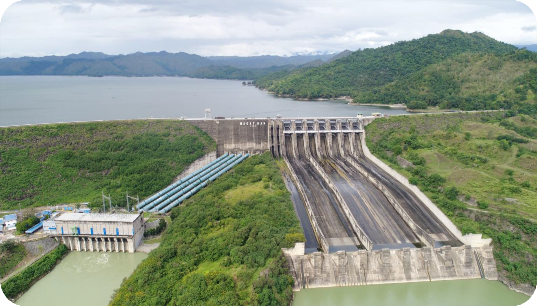
- To investigate, analyze, and evaluate reservoir sedimentation in the Vu Gia-Thu Bon (e.g., Song Tranh 2 dam) and Cagayan (e.g., Magat dam) river basins. Then, to develop an indicator for reservoir classification based on sedimentation rate and reservoir longevity;
- To propose potential technical solutions for removing accumulated sediment in reservoirs (a case study in Song Tranh 2, Vietnam, and Magat dam, Philippines);
- To develop an integrated flood and sediment management for sustainable development;
- To establish an association where the results from cooperation among scientists, stakeholders, decision makers, local communities, and private sectors can be transferred to the central government in implementing“integrated river basin management”.
2.2 Expected Deliverables/Outputs
The expected deliverables/outputs of the proposed project are:
- A collection of climate, topography, dams, river flow, sediment, morphology, and irrigation system datasets, which serve for not only this proposed project but also the future projects in the long-term collaboration.
- Hydrological models (e.g., SWAT) to simulate the rainfall-runoff and sediment yield.
- Hydraulic models (e.g., TELEMAC) to predict reservoir sedimentation and morphological changes in river estuary and coastline.
- Technology transfer from Japan to Vietnam and Philippines regarding techniques to mitigate reservoir sedimentation.
- Establish communication to initiate a science-government-community association (SGCA) where scientists, stakeholders, decision makers, and local communities participate into phases of the research. The goal is to consult to the provincial and central governments in implementing “integrated river basin management”.
- Train young researchers and stakeholders, policy makers, local communities through seminars and workshops(it will be online if Covid-19 continues).
- Publish data and research works to high ranking international journals and conferences
- Cooperate with other global programmes such as IPCC and to expand our collaborative network with other ASIAN countries.
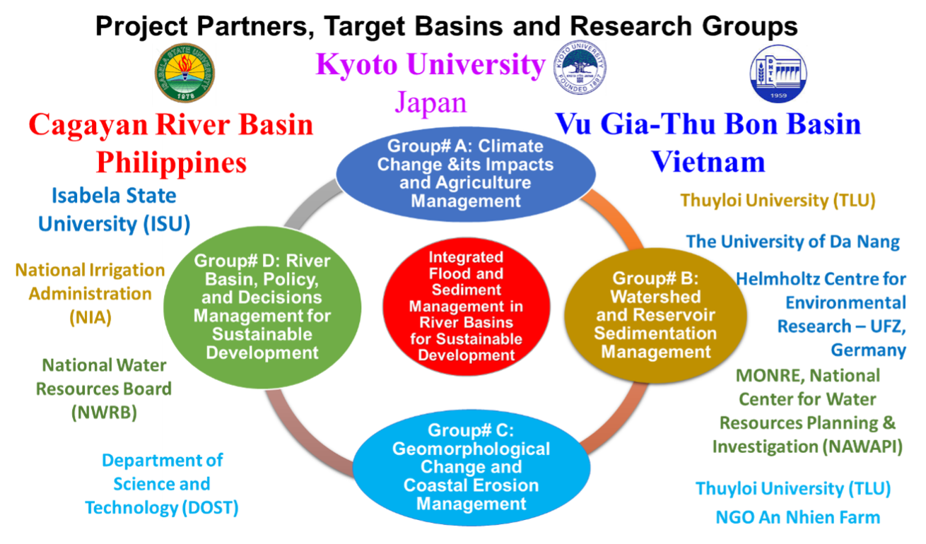
Project Partners
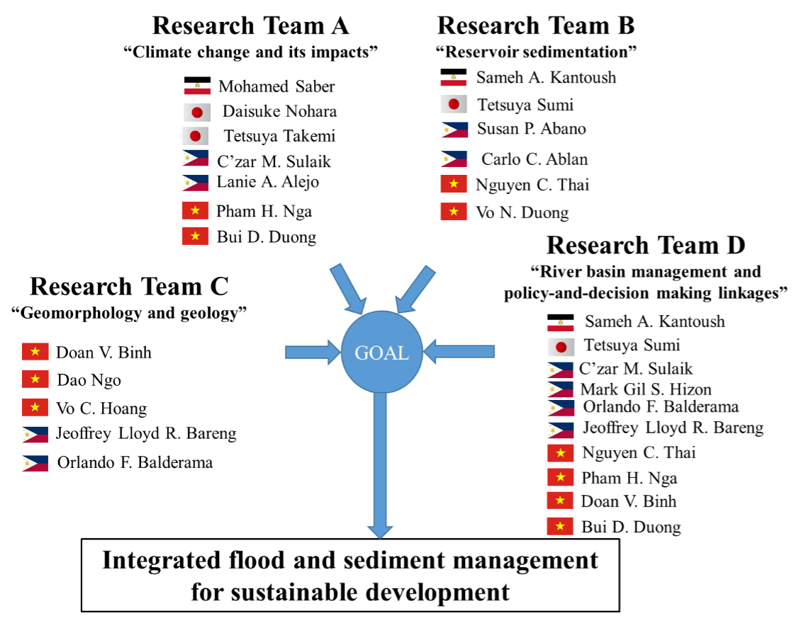
The main partners of this project are from three countries including Japan Vietnam and Philippines. The collaborators from institutes and universities as well as collaborative team from each partners are highlighted in the flowing figures.
Research Activities
Several parallel research activities were carried out over the Cagayan and Vu-Gui Thu Bon River Basins in the Philippines and Vietnam, including field surveys, flood simulation, and sedimentation assessment, etc.
1. Research topics
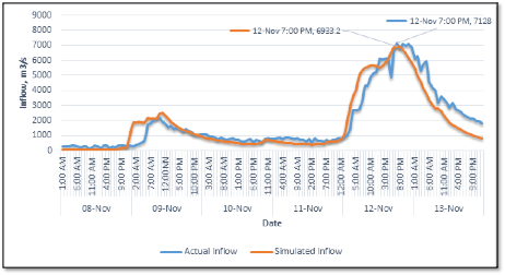
1.1. Calibration and validation of RRI modelling at CRB, Philippines
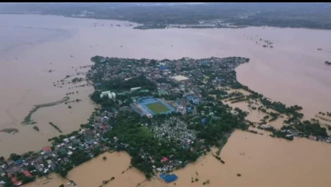
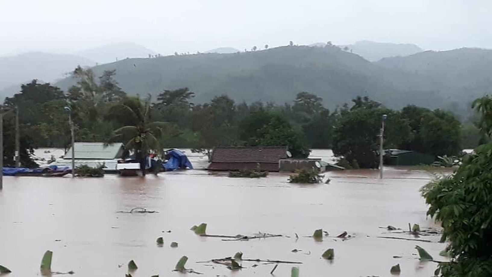
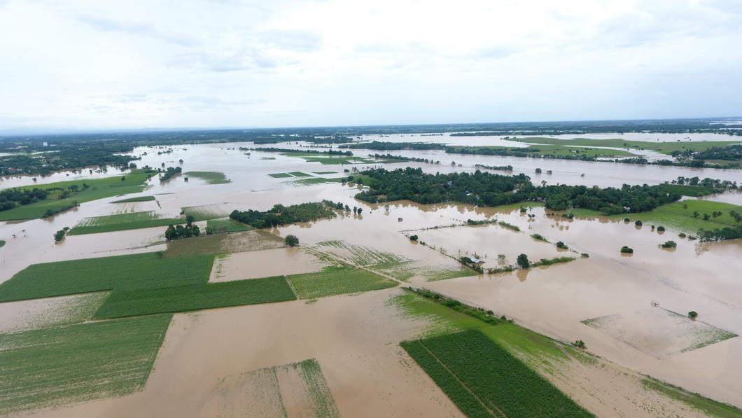
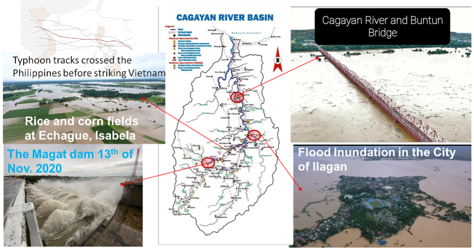
The RRI model of the entire Cagayan River Basin which includes the Magat River watershed was calibrated and validated during Typhoon Ulysses. The most severe typhoon in 2020, Typhoon Ulysses which caused flash floods in many places in Cagayan Valley particularly in Tuguegarao, Cagayan was used for the calibration of the RRI model. The RRI model was able to estimate the date and time of the peak inflow correctly relative to the observed peak inflow date and time (Figure 1.1).
Policy recommendations
Based on the results of the RRI modeling study, the following policies are recommended:
1. The NIA-MARIIS-DRD Flood Forecasting section should consider testing, use and adapt the calibrated RRI model for the Cagayan River Basin during Typhoons and extreme rainfall conditions
2. The calibrated and validated RRI model for CRB should be used to develop a decision support system for flood forecasting and flood warning system and used as a basis in pre-emptive release of water before the onslaught of typhoons and extreme rainfall conditions
3. The calibrated and validated RRI model for CRB should be used as input for updating the dam discharge protocol of Magat Dam to avoid late release of water during the onslaught of typhoons contributing further and untimely to floods downstream.
4. Properly designed flood control infrastructure should be constructed along the Cagayan River basin flooded areas as simulated by RRI to protect human lives and livelihoods
5. Nature-based solutions and projects should be implemented to reduce the negative impacts of extreme rainfall conditions in the CRB in the long-term especially in the watersheds of the sub-basins that contributes significantly to flooding downstream.
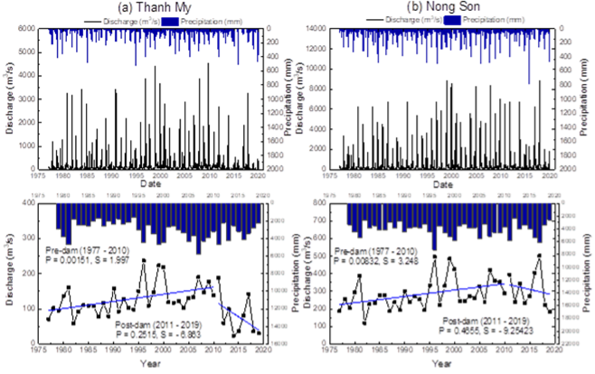
1. 2. Hydrological Modelling Over Vu Gia-Thu Bon River Basin, Vietnam
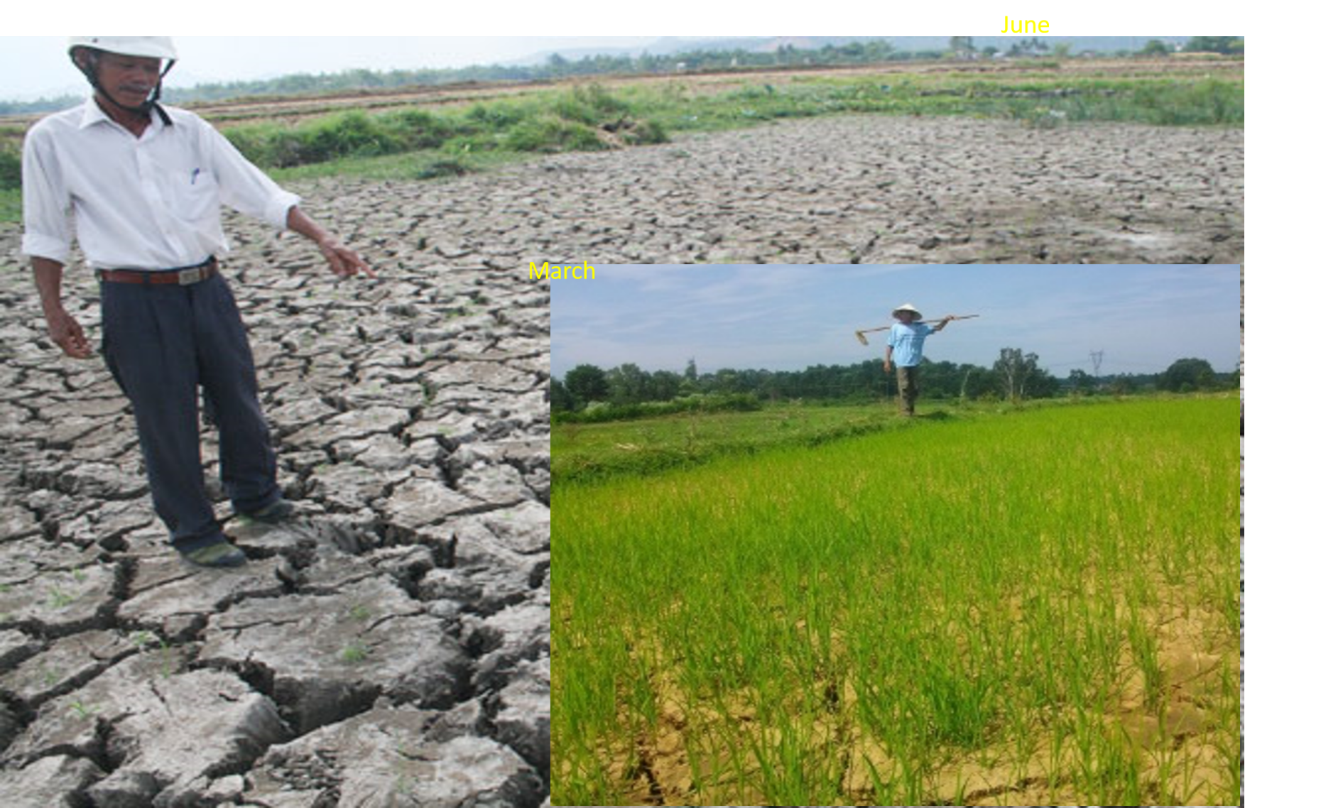
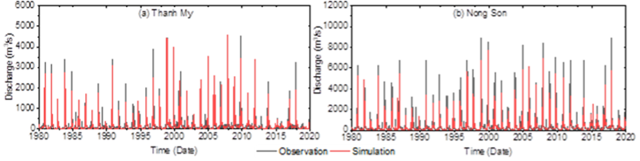
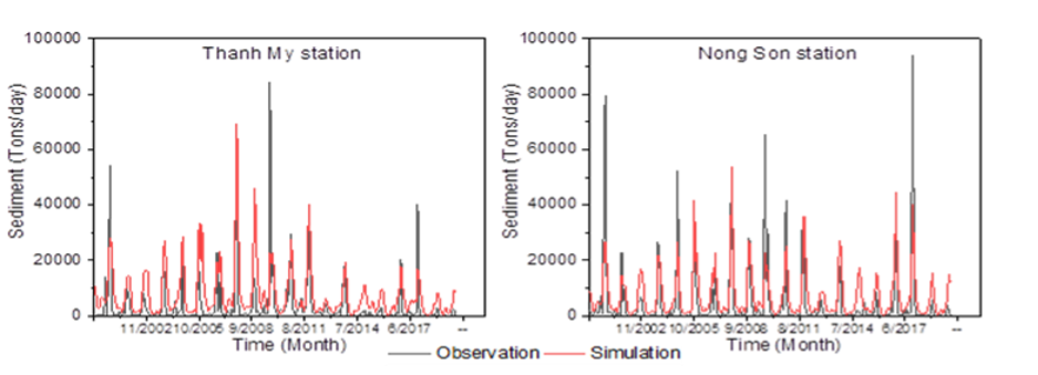
Vu Gia Thu Bon river basin is located in a tropical monsoon climate region, often affected by drought, saline intrusion, and flooding. These problems are exacerbated by climate change, upstream reservoir construction, and intensified agriculture. Consequently, the flow regimes have significantly altered. Research has evaluated long-term alterations of flow regimes at the Thanh My and Nong Son stations onin the Vu Gia and Thu Bon Rivers from 1977 to 2019, using different evaluation indicators and analytical methods. Understanding the long-term changes of the flow regime on the VGTB River basin is of vital importance to the strategy of sustainable management and sharing of water resources in the coming decades.
We found that these changes are largely dependent on the construction of hydraulic infrastructures. Therefore, the semi-distributed hydrological model SWAT was established over the entire VGTB basin for the period from 1979 to 2020 and simulated reservoir outflow from eighteen hydropower. The assessment approach developed in this study allows us to evaluate the interactions between climate, watershed, reservoir operation. Furthermore, it provides us with a tool to optimize reservoir operations on a daily scale to support water management for irrigation, water supply, and saltwater intrusion. The results of this study provide a detailed insight into the impacts of hydraulic infrastructures on the downstream water availability of the VGTB basin.
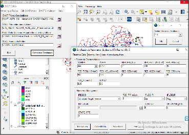
Setup SWAT model
2. Field Survey
2.1. Bathymetric Survey Results and Updates along Magat Reservoir at Cagayan River Basin, Philippines
The survey was conducted from May 18-June 04, 2021, along Magat Reservoir. This survey covered 8 ranges – from Range 1 to 8. The methods that were used were the Conventional Cross-Section Method using the single beam echo sounder, Real-Time Kinematic (RTK), and Total Station. The results of the Bathymetric Survey for Range 1 to 8 (main Reservoir) are explained below.
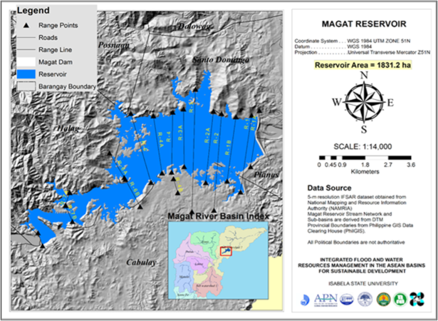
On June 10-25, right after the field survey, the team of NIA-DRD and ISU finalized the raw data to be analyzed further by NIA-DRD.
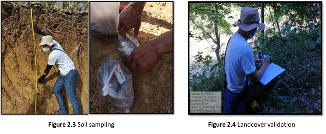
Field Validation and Data Gathering at Magat River Watershed
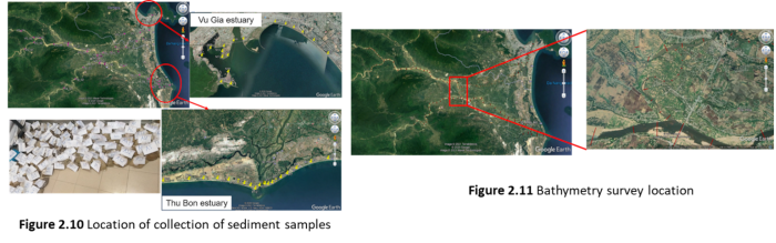
Fieldworks were conducted in the Magat River Watershed to validate the land cover and conduct soil sampling. Soil samples were collected for each dominant land cover and each sub-basin.
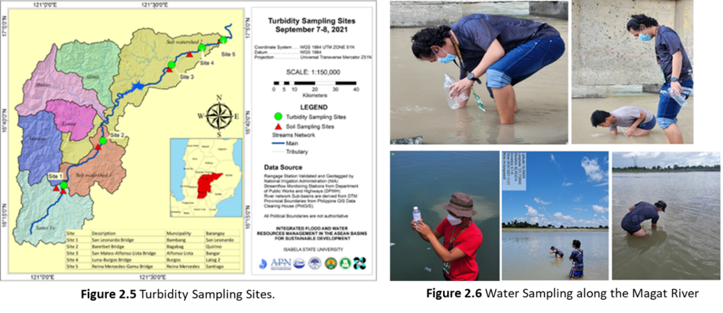
Water Sampling along Magat River
The water samples were gathered by taking 3 samples following the specified depth intervals: at the water surface, at the middle portion, and near the channel bottom. Different depths were considered to include variations of sediment being transported to the varying velocity of flow, which is higher at the surface and slower near the bottom due to relative friction at the riverbed. The samples were then analyzed using a calibrated portable turbidity meter.
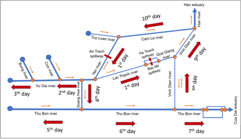
2.2. Field trip/survey and data collection activity report over Vu Gia Thu Bon River Basin, Vietnam
The field survey was conducted over VRB to measure the cross sections, discharge, flow velocity and turbidity along the Vu Gia Thu Bon River Basin, which are the necessary inputs for the project data analysis as well as for the on-going study using TELEMAC 2D. This has involved collection of the sediment samples along the riverbanks, floodplains, fields, roads, Experiment to determine the grain-size distribution, collection of flood marks to determine the frequency and extent of flooding etc.
3. Others (Instruments Installation, and Data Measurements)
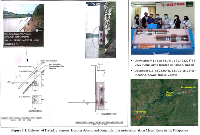
Installation of Turbidity Meter, and Measurements along Magat River, Philippines
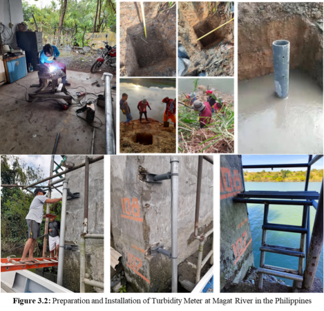
The project supported the purchase of two (2) units of turbidity meters from Japan, and delivered to the National Irrigation Administration - Magat River Integrated Irrigation System (NIA-MARIIS), for the installation of the proposed sediment transport monitoring. Figure 3.1 shows the location details as well as the design plan for the installation of these turbidity meters. Both turbidity meters have been installed successfully, with proper protection provided by additional pedestal support along the Magat River. Figure 3.2 illustrates the preparation and installation of turbidity meters along the Magat River.
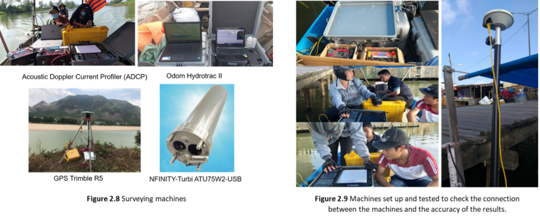
Acoustic Doppler Current Profiler (ADCP) measurement along VGTB, Vietnam
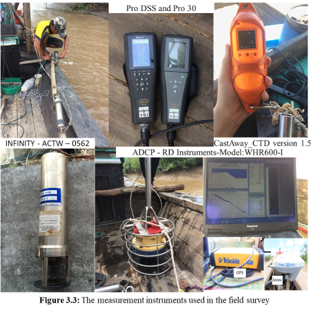
Various instruments such as Trimble Global Positioning System (GPS), ADCP, handheld Garmin GPS (Figure 3.3) were used to measure the river depths, velocities, and discharges along 570 km in three main rivers including the Hau, Tien and Vam Nao River and measure salinity concentration by Pro30 instrument.
River Basins
In this Project, we have two case studies: Vu Gia-Thu Bon river basin, in Vietnam, and Cagayan river basin In Philippine. More details are available below:
Notice: link the river basin with google maps
Vu Gia-Thu Bon river basin
There have been some studies on water-related issues. Brunn et al. (2013); VAST, (2012); LUCCi, (2017) have studied flood hazards and partial vulnerability in the Vu Gia-Thu Bon river basin. Ponsioen (2015) preliminarily investigated solutions to protect coastal erosion in the Cua Dai beach. Viet et al. (2015); Hoang et al. (2016); Do et al. (2018) studied morphological changes of Cua Dai beach by satellite image analysis and 1-line model. JICA (2003) conducted a master plan for nationwide water resources development and management in 14 major river basins in Vietnam, including the Vu Gia-Thu Bon river basin. JICA (2018) conducted a research on data collection survey on basin-based comprehensive sediment management in river systems of the central region in Vietnam. These data important for the proposed project.
-
General characteristics
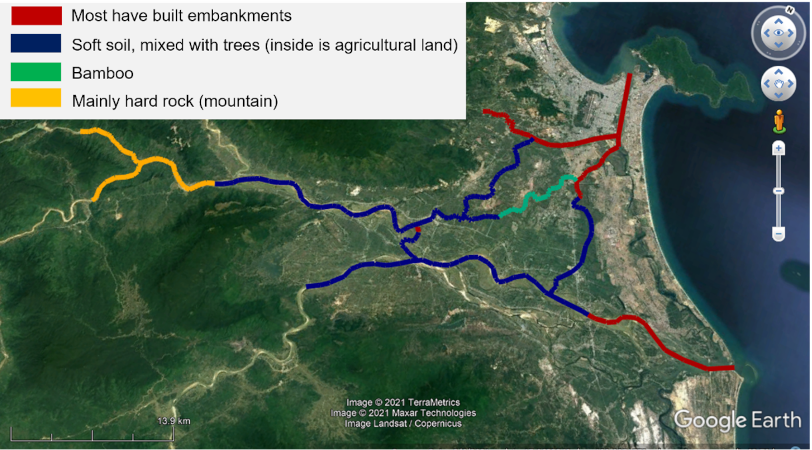
Vu Gia Thu Bon River basin is located on the East of the Truong Son mountain, in Quang Nam province, Da Nang city and part of KonTum Province, with a catchment area of 10,350 km2 (RETA, 2011) (Figure 8.1). The topography of the basin is mainly hilly, with an average slope of 25%, accounting for 60% of the total catchment area. The river network includes 78 river branches, of which the main rivers are Vu Gia River and Thu Bon River. The average river density in the upstream area is 0.38km/km2, and in the downstream area is 0.57km/km2 (Vu et al., 2011). Land used mainly in the basin is forest (accounting for 62.05%), the main soil type is clay and silt loam (accounting for 83.33%).
The basin's water volume accounts for about 2.5% of the total water volume in Vietnam (RETA, 2011). Upstream there is a water transfer between the two rivers, water from the Vu Gia River is transferred to the Thu Bon River by the Dak Mi 4 hydropower plant. Downstream, the Quang Hue River partially transfers the flow from Vu Gia River to Thu Bon River.
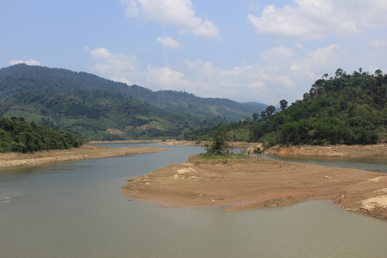
Existing hydraulic structures are mainly pumping stations and weirs for the purpose of water level maintenance and water pumping. The irrigation reservoirs have limited capacity, so it is not possible to provide more water for irrigation during the dry season. That is why droughts and saline intrusion often cause serious damage and affect people's lives.
Figure 8.1: Vu Gia - Thu Bon River basin -
Meteorological characteristics
The river system is located in the tropical monsoon climate, divided into two seasons, the dry season and the rainy season affected by storms. Rainfall tends to increase from low altitude to high altitude areas. The average annual rainfall of the entire basin is 2,841mm. The average annual rainfall varies significantly from 2,161mm in the lowlands to over 4,155mm in the southern mountainous areas. Rainfall varies by season, with 48-81% of the annual rainfall concentrated in September to December (Figure 8.2).
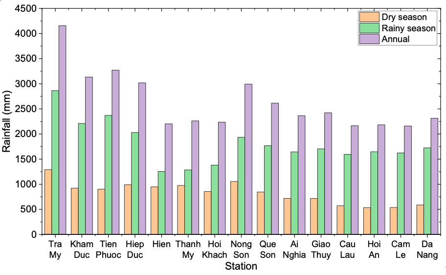
Figure 8.2. Rainfall characteristics of rain gauge in the Vu Gia Thu Bon Rdiver basin (data observed from 1979 - 2019) -
Hydrological characteristics
Due to the difference in the rainfall distribution, the runoff in Vu Gia Thu Bon varies significantly between seasons. The flood season from October to December corresponds to the biggest rainy period. Flow in this period accounts for about 62.5% - 69.2% of the total annual flow, the largest is November. The driest month is April, accounting for only 2% - 3% of the annual flow (RETA, 2011). During the dry season, from January to August, the low-flow in the basin is divided into two periods: from January to April, this is the period with stable flow, the flow is provided mainly from reservoirs. In the period from May to August, the flow is not stable and depends mainly on groundwater and water from the Tieu Man floods.
During the dry season, the upstream of major rivers have the largest runoff, the flow module is 25 - 30l/s/km2. The North and Northwest regions of the basin have the smallest runoff, with a flow module of 15l/s/km2. In mountainous areas, aquifers are not destroyed and there is a strong interaction between surface water and groundwater. During the dry season, 85% of the surface runoff comes from groundwater (RETA, 2011).
The tidal regime is a mixture of diurnal tide-semi-diurnal tide (daily/semi-daily), with 1 to 8 diurnal days in a month, an average of 3 diurnal days per month. The tidal range in Da Nang city has an average water level of 70cm and the highest water level of 140cm (RETA, 2011).
-
Dams implementation
- The Vu Gia Thu Bon River basin is one of the major river basins of Vietnam which is ranked 4th in terms of hydropower potential (ICEM, 2008). At present, there are fourteen hydroelectric power plants built and operating in the basin. In which, there are eight major hydropower plants including: A Vuong, Song Bung 2, Song Bung 4, Song Bung 5, Dak Mi 1, Dak Mi 4 and Song Con 2 on Vu Gia River, and Song Tranh 2 on Thu Bon River. The total capacity of all eight projects is about 1,100MW (Figure 8.1).
The Cagayan river basin
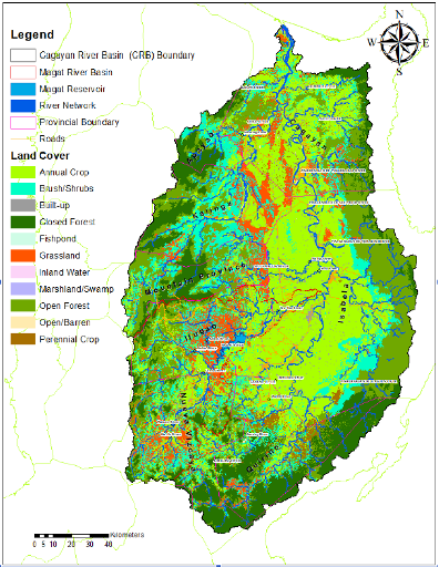
The Cagayan River Basin(CRB) encompasses the provinces of Cagayan, Isabela, Nueva Vizcaya, Quirino in Region 2; portions of Mountain Province, Ifugao, Kalinga, Apayao, and Benguet in the Cordillera Administrative Region (CAR); as well as parts of Aurora and Nueva Ecija in Region 3. The basin is roughly elliptical in shape with its major axis oriented in a north-south direction. The Cagayan Valley is relatively flat but mountains ranges with elevations up to 2,000 m surround the east, south and west of the basin. The basin is the largest basin in the Philippines with an estimated drainage area of 27,281 sq km and length of about 520 km. the land use covers classes are shown in Figure 8.3
The annual average rainfall in the basin is estimated to be 2,600 mm with an average annual run-off of 1,343.2 cu.m per second. It travels in the Cagayan Valley from the south to north in the northern part of Luzon Island. Since the Cagayan river takes route closer to the Sierra Madre Mountains, the right tributaries are generally of steep slope and smaller in scale. The major tributaries are the Magat river (5,113 km2), Ilagan river (3,132 km2), Siffu-Mallig river (2,015 km2), and Chico river (4,551 km2). The river bed slope is 1/8,680 between the river mouth and Tuguegarao in the main river.
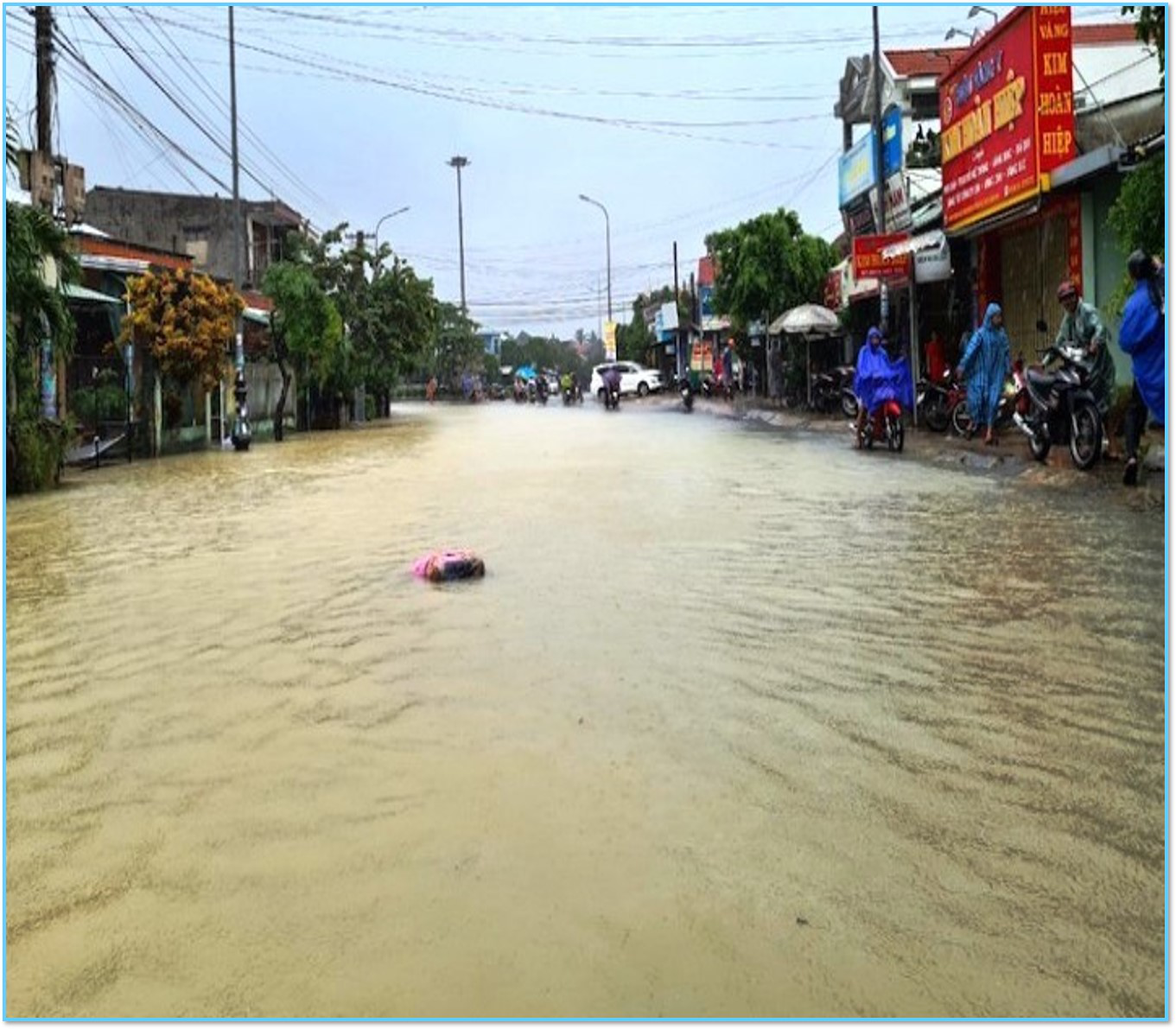
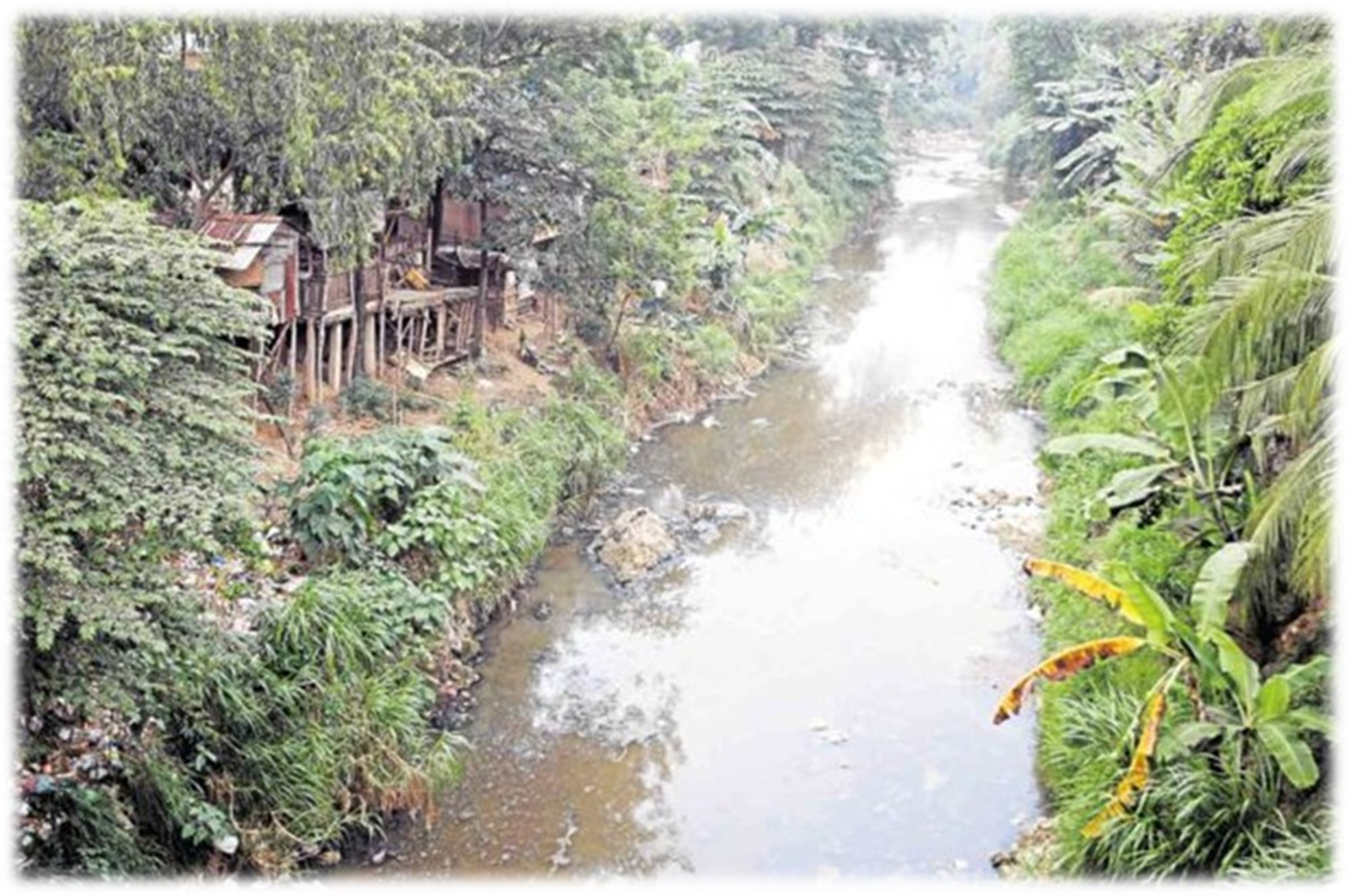
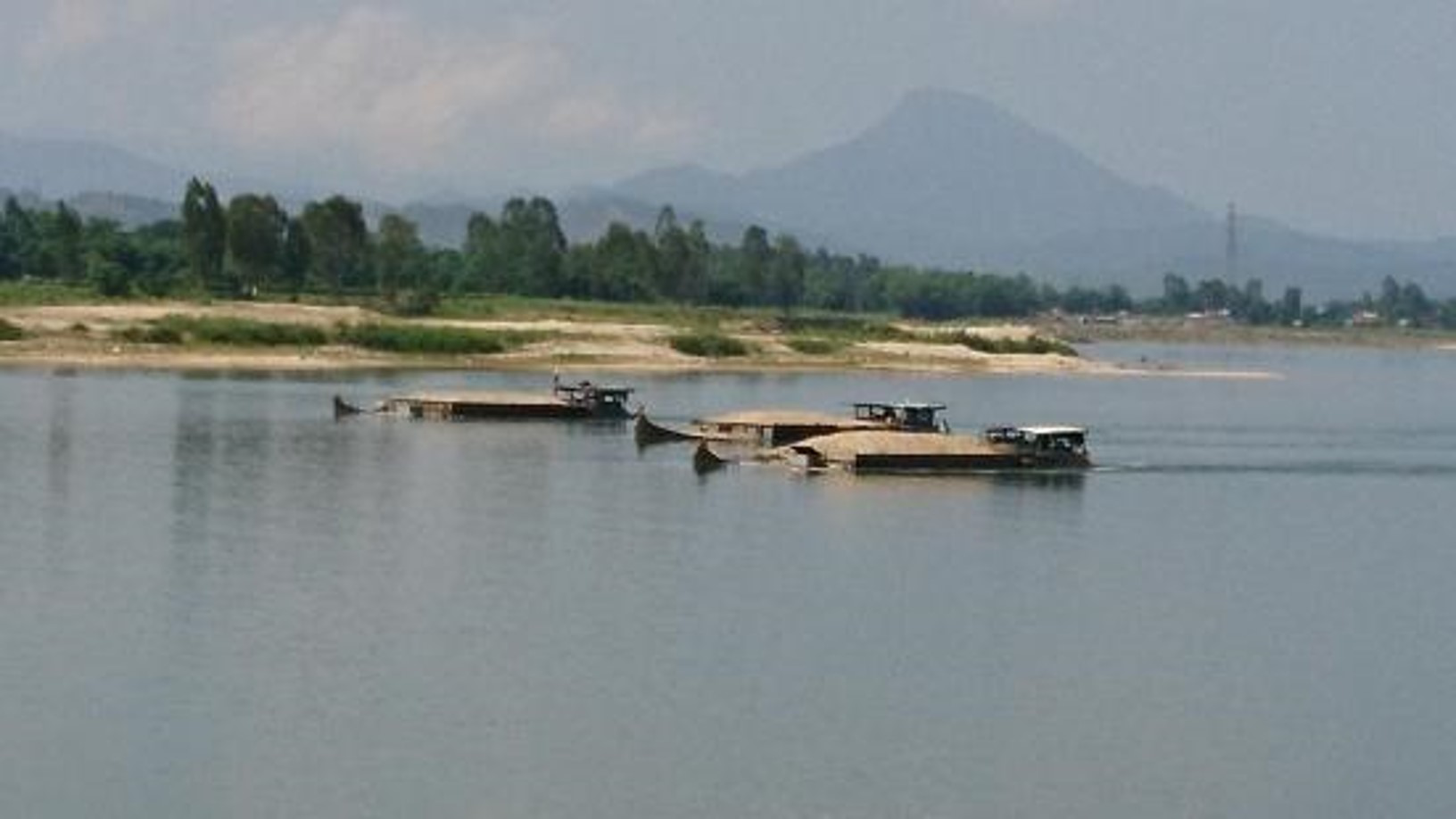
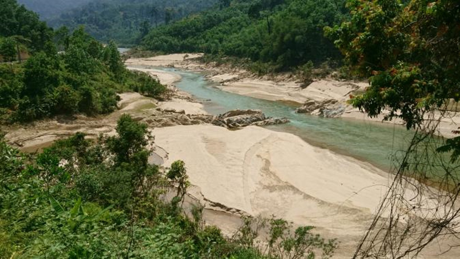
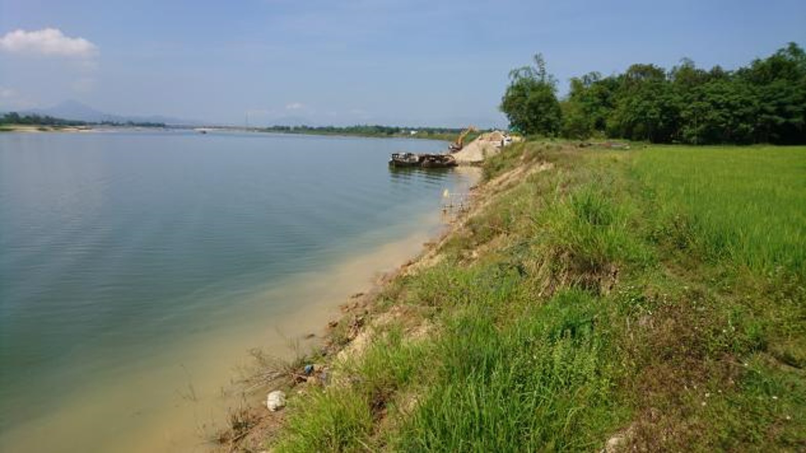
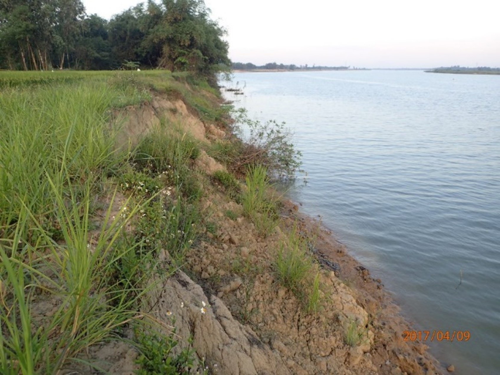
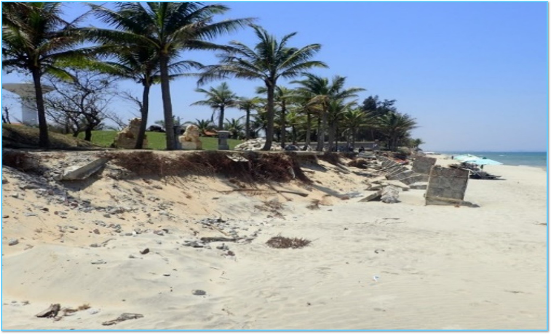
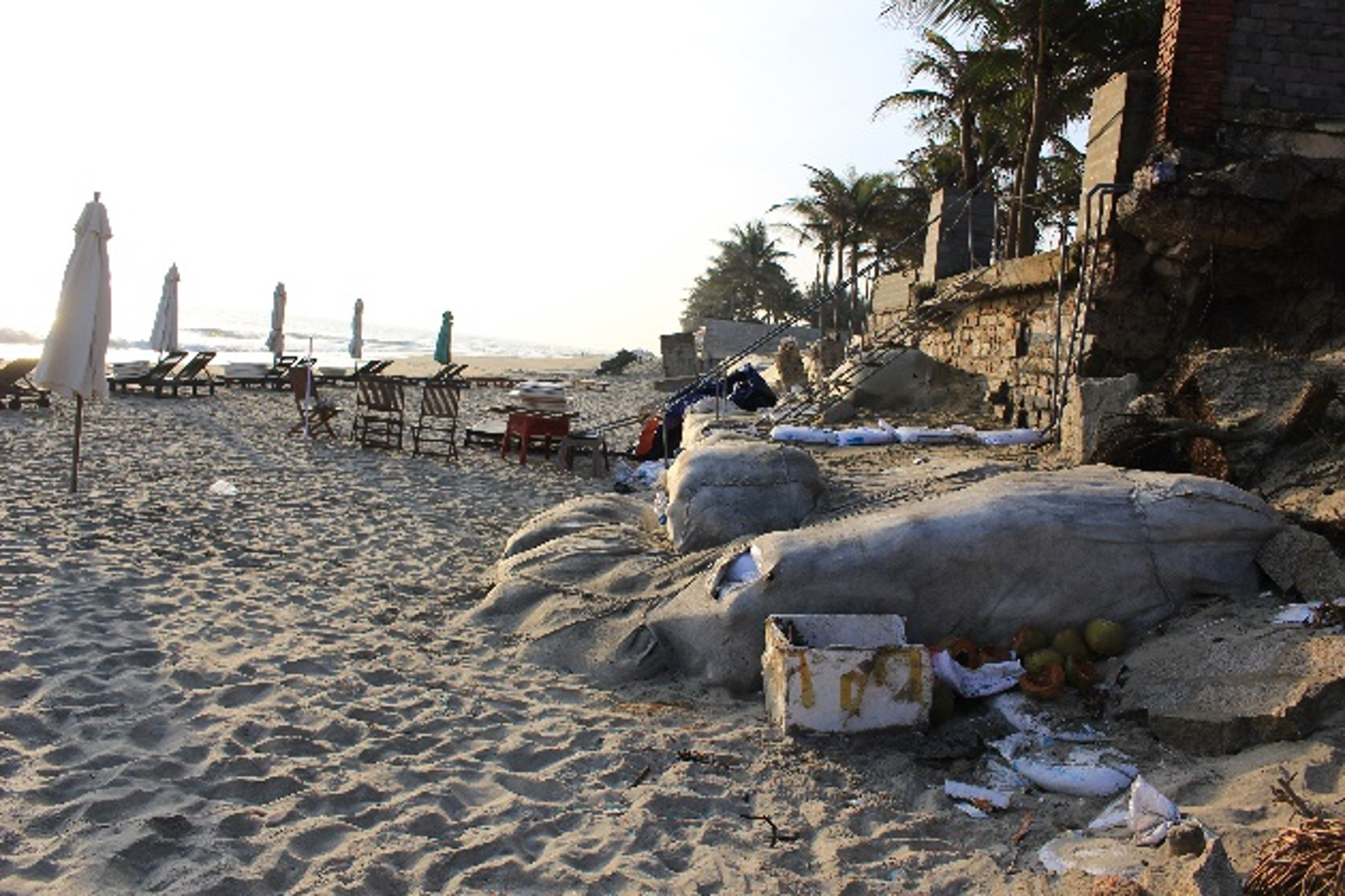
APN Photo Gallery