In order to develop the main concept of the project, the challenges and problems of the river basin should be addressed and highlighted first as follow:
A. Challenges of River Basin
caused by climate change and anthropogenic activities.
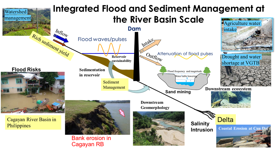
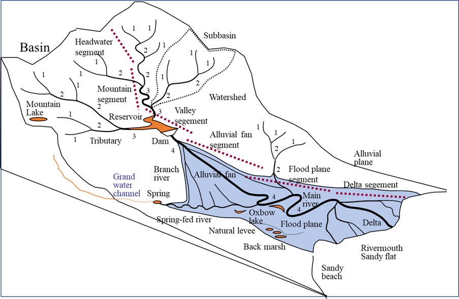
WE classified the river basin system to different zones (Upstream reach, Dam and Reservoir Reach, Middle and Downstream Reaches, and Coastal and River Mouth Reaches) with the related challenges as follow.
- Ⅰ. Upstream Reaches
- Steep slopes/ high Rainfall
- Highly active erosion
- Soil loss from cultivated lands
- Burn farming & logging activities
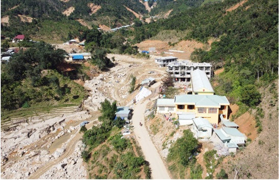
- Land slides
- Sediment yield
- Limited watershed monitoring
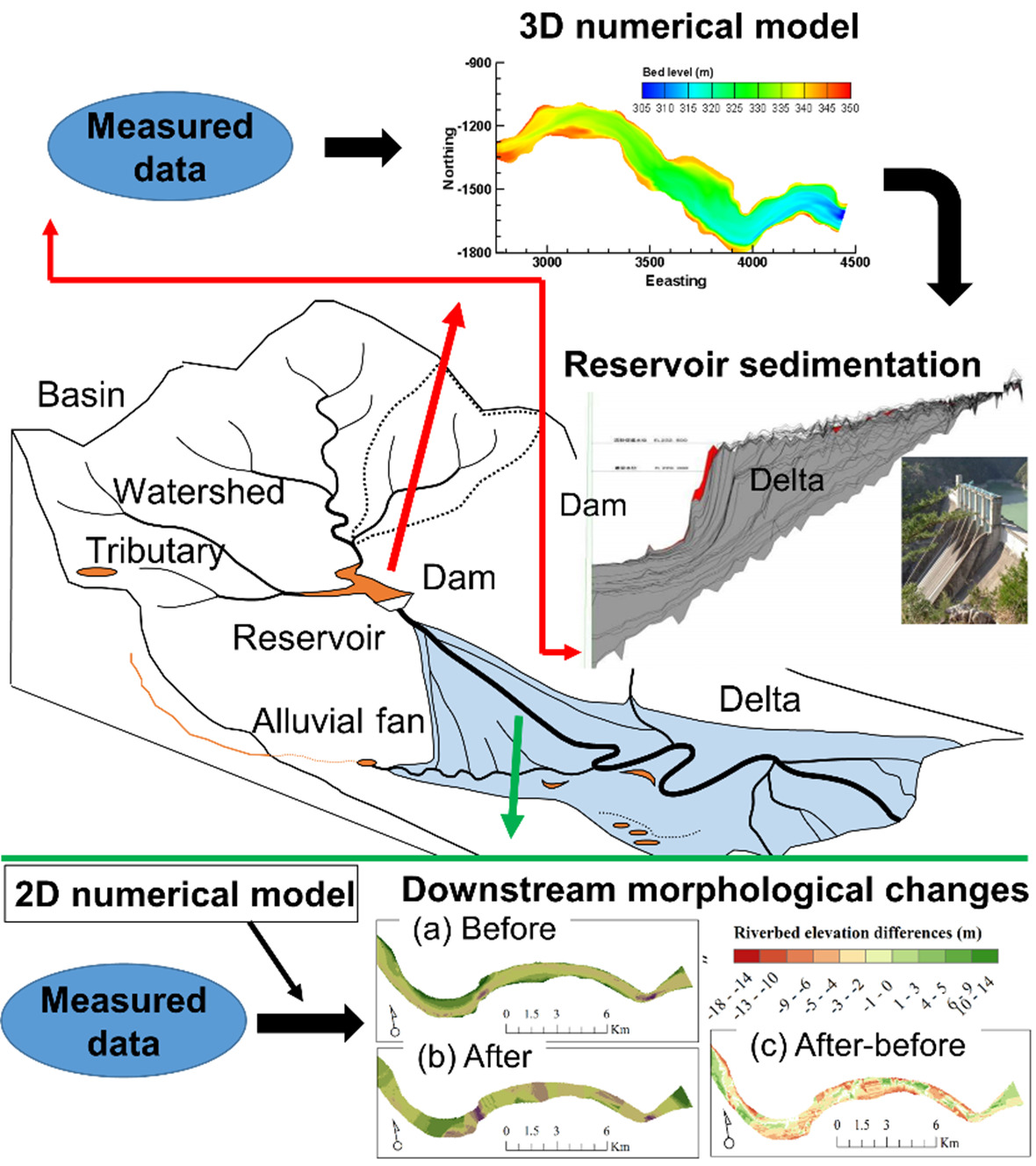
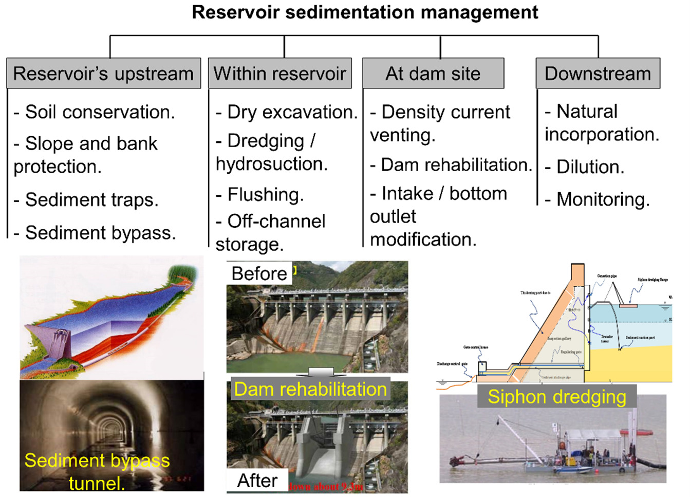
- Ⅱ. Dam and Reservoir Reach
- Reservoir sedimentation (reduction of Cap.)
- Impacts of backwater build-up depositions
- Fish cage operators and soil cultivation
- People cut trees and destroy soil covers
- Ⅲ. Middle and Downstream Reaches
- Inundations at the tributaries and flood
- Water inadequacies in irrigation and domestic water supply
- Dynamic morphological changes
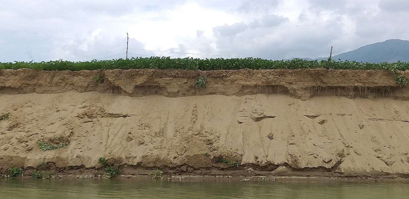
- Bank erosion and river bed incision
- Modification of flow & sediment regimes
- Water quality
- No bank protection works
- Difficulty in implementing large-scale flood control project
- Various management entities
- Ⅳ. Coastal and River Mouth Reaches
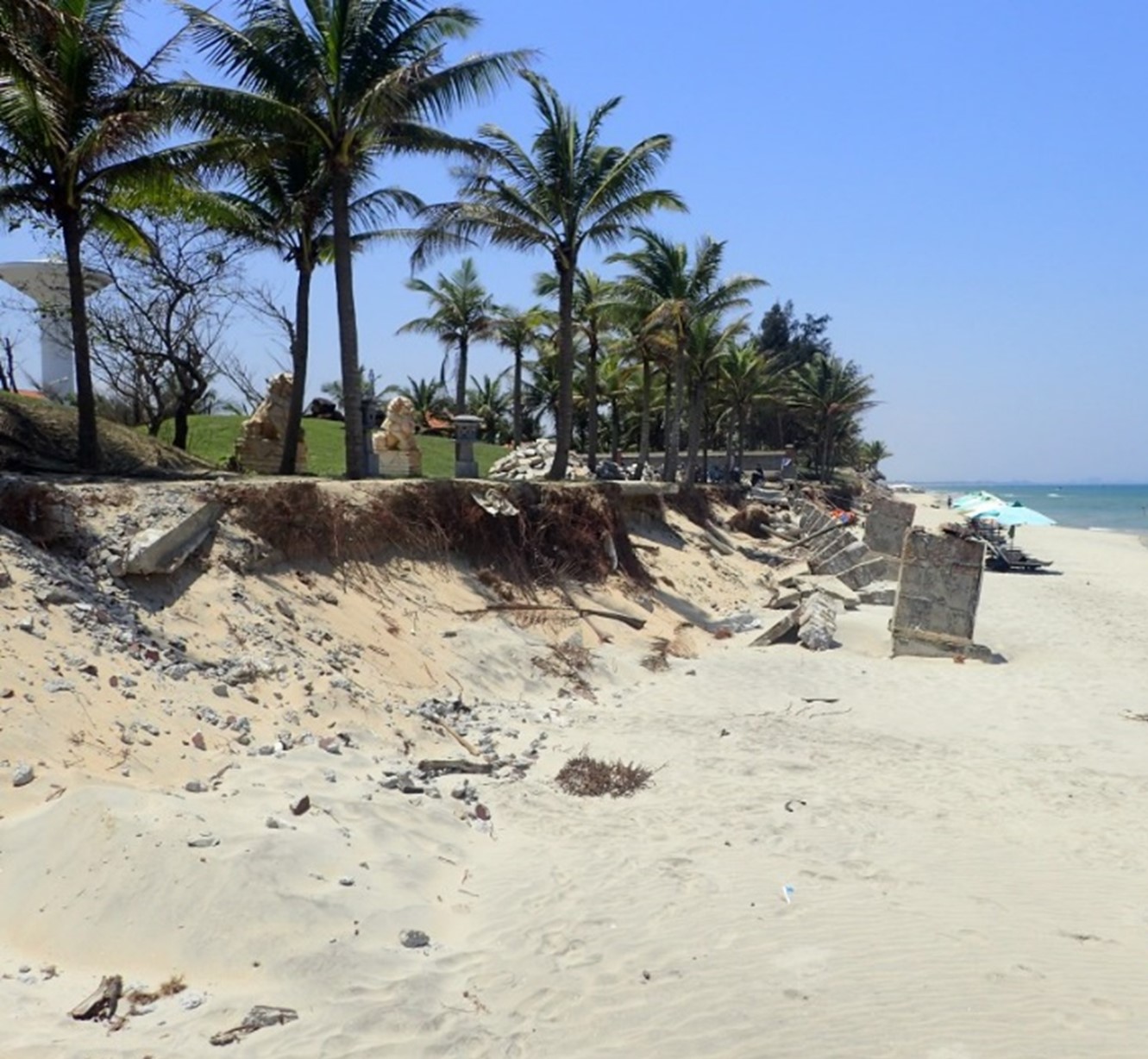
- Coastal erosion
- Salinity intrusion and water logging
- Increased concentration of pollutants
- Degradation of biodiversity and ecology
- Social and environmental impacts
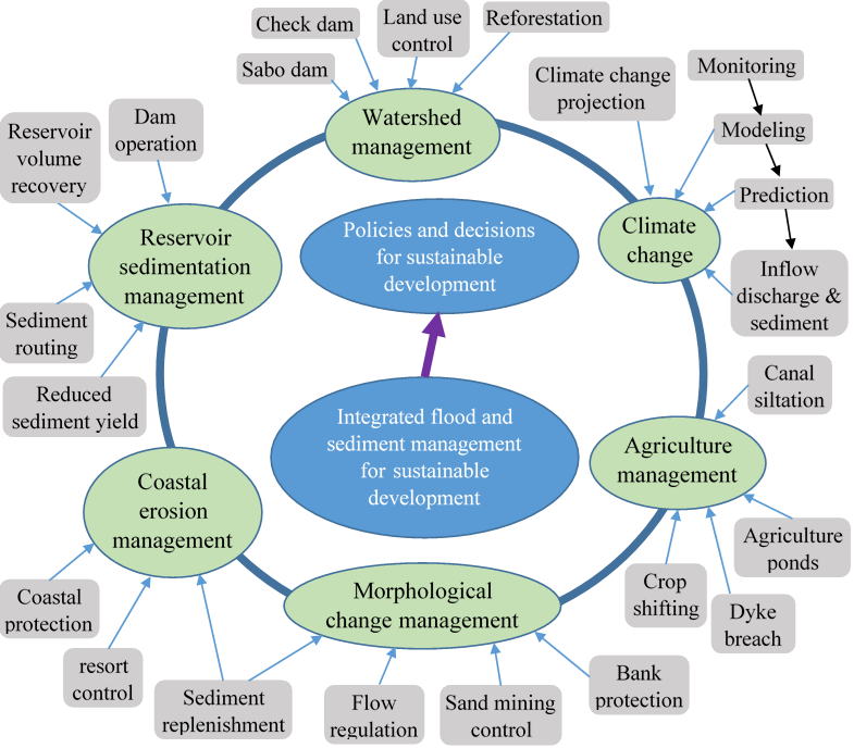
B. Project Concept
The proposed project consists of seven (7) main components:
- Climate change, and flood and drought management
- Watershed management
- Reservoir sedimentation management
- River morphological change management
- Coastal erosion management
- Agriculture management
- Linking integrated flood and sediment management to policy- and decision making
Methodology
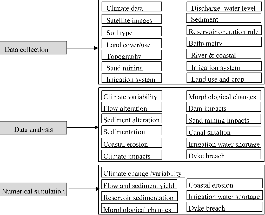
The general proposed methodology of this project starts with data collection of various data types. Then, data analyses are performed to understand the fundamentals of the study areas and phenomena concerned. Next, numerical models are established to predict the future changes of the concerned problems so that countermeasures can be proposed. Detailed methodology of each research component is explained bellows:
The research activities to accomplish the project objectives following the proposed methodology include:
- Simulation of the reservoir sedimentation
- Reservoir sedimentation management